The Pole Shift and Planet-X (Nibiru) Research:
Planet X to Eclipse the Sun in 2017-Come into View When the Great Sign Appears Published on Jul 20, 2017
Full interview with David Meade, author of Planet X-The 2017 Arrival.
The Nibiru cataclysm is a supposed disastrous encounter between the Earth and a large planetary object (either a collision or a near-miss) which certain groups believe will take place in the early 21st century. Believers in this doomsday event usually refer to this object as Planet X or Nibiru. The idea that a planet-sized object will collide with or closely pass by Earth in the near future is not supported by any scientific evidence and has been rejected by astronomers and planetary scientists as pseudoscience and an Internet hoax.[2][3]
!!!!!! NEW !!!!!Earth Tilting to the South-Axis of Rotation off Balance-Oceans in Opposition: Sky Watch Media News
There have been many bizarre events that have happened since the time of the Grand Eclipse of August 2017 suggesting that the great spectacle in the sky was, in fact, the precursor to a sequence of horrific events that will come upon the earth in what we now call the latter days.
The idea was first put forward in 1995 by Nancy Lieder,[4][5] founder of the website ZetaTalk. Lieder describes herself as a contactee with the ability to receive messages from extra-terrestrials from the Zeta Reticuli star system through an implant in her brain. She states that she was chosen to warn mankind that the object would sweep through the inner Solar System in May 2003 (though that date was later postponed) causing Earth to undergo a physical pole shift that would destroy most of humanity.[6] The prediction has subsequently spread beyond Lieder's website and has been embraced by numerous Internet doomsday groups, most of which linked the event to the 2012 phenomenon. Since 2012, the Nibiru cataclysm has frequently reappeared in the popular media; usually linked to newsmaking astronomical objects such as Comet ISON or Planet Nine. Although the name "Nibiru" is derived from the works of the ancient astronaut writer Zecharia Sitchin and his interpretations of Babylonian and Sumerian mythology, he denied any connection between his work and various claims of a coming apocalypse.

Zecharia Sitchin and Sumer[edit]
Although Lieder originally referred to the object as "Planet X", it has become deeply associated with Nibiru, a planet from the works of ancient astronaut proponent Zecharia Sitchin, particularly his book The 12th Planet. According to Sitchin's interpretation of Babylonian religious texts, which contradicts conclusions reached by credited scholars on the subject,[24][25] a giant planet (called Nibiru or Marduk) passes by Earth every 3,600 years and allows its sentient inhabitants to interact with humanity. These beings, which Sitchin identified with the Annunaki of Sumerian myth, would become humanity's first gods.[26] Lieder first made the connection between Nibiru and her Planet X on her site in 1996 ("Planet X does exist, and it is the 12th Planet, one and the same.").[27]
However, Sitchin, who died in 2010, denied any connection between his work and Lieder's claims. In 2007, partly in response to Lieder's proclamations, Sitchin published a book, The End of Days, which set the time for the last passing of Nibiru by Earth at 556 BC, which would mean, given the object's supposed 3,600-year orbit, that it would return sometime around AD 2900.[28] He did however say that he believed that the Annunaki might return earlier by spaceship, and that the timing of their return would coincide with the shift from the astrological Age of Pisces to the Age of Aquarius, sometime between 2090 and 2370.[29]
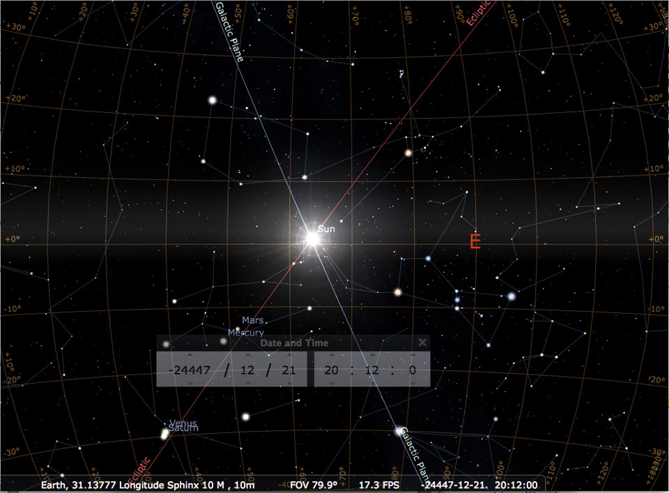
Nibiru-Nemesis System Interacts with the Sun- 2017 Eclipse Becomes Harbinger of Portent for America
On August 21 millions of Americans witnessed a great solar eclipse that extended for several hours across the heartland of the United State. Many who saw that grand spectacle in the sky commented that they had felt quite strange, a strong feeling of apprehension at the moment that the moon was crossing in front of the sun. What was it about the eclipse that seemed to have so many observers feeling uneasy? In the days following the eclipse, extreme weather events happened on a global scale that would have devastating effects on millions of people from Texas to Southeast Asia. It is hard to ignore these events when considering the extreme nature of their occurrence. Skywatch Media News-The Best Source for Alternative News on World EventsStopped Rotation
Prior to the shift, the Earth slows in its rotation, and actually stops. This is recorded in written history and spoken folklore, worldwide, as a long day or night. The explanation for slowing rotation resulting in a stopped rotation during the week prior to the shift is that the passing planet grips the Atlantic Rift magnetically, so the Earth does not turn past this grip.
Last Updated December 24, 2002
This part of the globe is centered between land masses that are fairly neutral in magnetic polarization, but lines up over former lava flows from the renting apart of the continents, the mid-Atlantic rift. The Pacific trench lies deeper under the water and its characteristics differ in composition from the newer magma that has arisen during continental drift.
Thus, the Atlantic lava beds are gripped, facing the Sun, facing the approaching planet coming up from the South along the rift, and causing both Europe, the Americas, and Africa to be on the long day side of the Earth.
Atlantic Stretch
The Atlantic has clearly been stretched and ripped in the past, with shorelines on both sides of the Atlantic being dragged down such that the remains of forests can be seen underwater off the East Coast of the North American continent, and buried roadways under the waves near Bermuda, and likewise land shelves west of the British Isles. The Atlantic Rift, running the entire length of the Atlantic between the present poles, shows recent tears, and in Africa the rifts increasingly separating the Arab lands from the continent proper are already showing some stress.
During the week of rotation stoppage, however, this is extreme, so that the Atlantic Rift is under a great deal of tension and the shorelines are drawn down along both sides of the Atlantic. Europe and Africa are continually pulled eastward, by the rotating core. Thus, the Earth moans in her agony, during this week.
Pacific Compression
Along the Pacific Rim, plates are being pushed under the Americas, and creating distress in Indonesia as compression of the Pacific is already in process from prior pole shifts and subducting plates are inclined to continue this momentum. The Himalayas, driven high from sea bed material in the past, also show a point of drama, already scripted for India and Australia by past dramas which positioned these plates thus.
Quakes all along the west coast of the Americas increase, and volcanic activity in Japan and Indonesia become extreme. India shutters, jerking under the Himalayas in spurts, creating great panic among her peoples who are already fearing the worst with the long evening they are experiencing. Tidal waves are not yet a problem, as the waters normally pooling around the equator have equalized around the globe, more water at the pole and less in the equatorial regions.
The dusting with red dust should be considered a warning to take cover, under metal or sod roof structures, out of the wind. The shift cannot be more than a few hours away. The dusting with red dust occurs less than 24 hours, and most likely less than 12 hours.
This depends upon a number of factors, including how well the dust drops through the atmosphere to be deposited on land where the very first evidence will be closely watched for and thus observed. In one location, the first sign of dust may be 18 hours ahead of the shift, and all run in panic to shelters. In another location, dust may not be noticed until heavy, perhaps 6 hours ahead of the shift, a good time to head for the shelters in any case.
The tail sweep will then proceed from red dust to hail stones just ahead of the shift. A normal roof would protect from the hail stones, which will be like the hail experienced during violent windstorms, where hail of ice falls and ruins crop.
Pole Shift
There is a great deal of tension that builds between the crust of the Earth and the core of the Earth during the week of rotation stoppage. This tension is released when the core of the Earth breaks with the crust, and moves. However, the core of the Earth drags the crust with it. The pole shift is therefore sudden, taking place in what seems to be minutes to humans involved in the drama, but which actually takes place during the better part of an hour.
There are stages, between which the human spectators, in shock, are numb. At first there is a vibration of sorts, a jiggling, as the crust separates in various places from the core. Then there is a Slide, where the crust is dragged, over minutes, to a new location, along with the core. During the slide, tidal waves move over the Earth along the coast lines, as the water is not attached and can move independently.
The water tends to stay where it is, the crust moving under it, essentially. When the core finds itself aligned, it churns about somewhat, settling, but the crust, more solid and in motion, proceeds on. This is in fact where mountain building and massive earthquakes occur, just as car crashes do their damage on the point of impact, when motion must stop.
Hurricane Winds
During the shift, the atmosphere of the Earth does several things, all at once. It drags along with the Earth. It moves as a mass, pushing on air in other places. Thus, even in those places on the Earth which are not moving, during the shift, being pivot points, the air is turbulent. It swirls, as circular motion in air masses is the response to conflicting forces, as seen in the circular motion of tornadoes and hurricanes.
One should not assume a force of winds above what the world experiences today. Your hurricanes and typhoons represent what occurs when air masses attempt to move against each other, given their density and gravity attraction and inertia. These same factors are in place, are predominant, during the pole shift. Stay below the Earth’s surface, lie low, and tie down everything you wish to find when it’s over.
Earthquakes
Tearing of continents is less traumatic than it would seem to humans, who imagine the continents as one plate and think of how lumber resists being torn, metal bends and twists before tearing, and a rope of fibers resists while the fibers snap one by one. Continents are in fact an overlay of many plates, and faults are where most of the plates have fractured in the same place. The continents are attached because some of the plates have not fractured.
Thus, ripping apart of continents is no more traumatic than subducting or slip-sliding. The land along the edges generally retains its altitude, as this was determined by the thickness of the plates, thus its buoyancy on the sea of lava. Solid land is composed to a great degree from the lighter elements, which rose to the top during the early cooling of planet Earth, and thus formed the floating crust.
Mountain Building occurs during rapid subduction of one plate under another. There is friction between the plates, so that crinkling of the upper plate occurs. This crinkling represents pressure and release, which can result in violent jerking and upheavals, sometimes snapping to create new cliffs or jutting rock. Those riding on the upper plate during these moment will be heaved skyward and dashed, with scarcely a safe place to cling to. Subduction can release pressure by pushing flakes of land that separate from lower stratas forward.
This thrust can be sudden and projectile, with the rock flake then crashing down again. Pressure and release can also create crumpling land where such activity is not expected. Compressed rock can also drive horizontally, into nearby soil or space not occupied by anything as dense as itself. Thus, those in a valley can find rock shooting out of a hillside, or rock spears shooting under their feet, unexpectedly. Surviving the mountain building process while in the mountains is precarious, and not advised.
Firestorms
During the comet’s passage, there is such an onslaught to the Earth’s upper atmosphere that the available oxygen in places is completely consumed. Heated gas in the comet’s tail form petrol chemicals due to the flashes of lightning and intense heat due to passage over open volcanoes, and these petrocarbons rain down, a sheet of flame falling to Earth.
With the atmosphere scattered, these petrol chemicals descend close to the surface of the Earth before bursting into flame. A fire storm, killing all beneath it. All this has been reported in ancient times, as humans observed accompaniments to the cataclysms. This type of activity sets forests afire. Where vegetation re-grows, from seeds and roots, many areas will nevertheless be denuded of vegetation for some time.
Flood Tide
During a pole shift, the ocean as a whole is on the move because it stays behind while the crust moves, and thus rolls up on land onto the coastline being pulled under it. This is a flood tide, with the lip of the water being its highest point, rising like a silent tide endlessly on the rise, the wave rolling inland without a crashing back and forth, just a steady progressive inundation. To those at the mercy of such a flood tide, their first thought is to climb above the tide. Soon they are standing on the highest point they can reach, and still the water, flowing inland steadily, rises.
Afloat on a boat or flotsam, they will be dragged inland with the flow until a reverse slosh begins, the water flowing back into its bed but in the nature of water during a slosh, overshooting this other side so that both sides of the ocean experience this flood tide, alternately, for some days until the momentum diminishes. When the flood tide recedes, those afloat are in danger of being dragged far out to sea with the flow, as the water will rush to its bed unevenly, more rapidly where it can recede the fastest.
Where tidal waves meet mountains, this can result in tidal bore up ravines. Where tidal waves flow inland, this results in a flood tide going hundreds of miles inland. Where the Atlantic widens and tears apart the North American continent along what is already her sea-way, there will be more places for the water to pool than water available, and this will cause a rushing toward this part of the globe by water gathered at the poles.
There will be a temporary lowering of water in the Indian Ocean, which will draw water from where it has gathered at the South Pole. Where the Pacific shortens dramatically, the water in the Pacific will find its bowl suddenly smaller, and will rise along shores on both sides. Given the size of this ocean, and the ability of her waters to rush over low-lying areas in Central America or around Australia, tidal waves along the Pacific coast are not substantially larger than along other coasts.
A Scripted Drama
Back to Contents
- As the South Pole, gripped by the passing North Pole of the 12th Planet, moves north, the crust is torn from the core and freed in this way, allows pre-existing stress points to relax. Thus, Europe and Africa move further east, allowing the Atlantic to rip apart, during the slide northward.
- The immediate affect of the massive plate housing Europe and Russia and the Near East to move is felt most strongly in India, as the Himalayas are driven over India at this point, effectively submerging this country in a wink.
- The effect of the Indio-Australian plate taking a dive under the Himalayas is to relieve tension along the African rift, such that this tears, promptly, but in shuddering steps with halting adjustments pauses between shudders. In essence, the movement eastward of the African continent is a momentum creating this tear.
- During the tearing of the Atlantic, and the dragging north or the North American continent, an already existing tear in the St. Lawrence Seaway tears further, essentially the weak link in this landmass held at so many points to the further side of the Atlantic. Canada move north, while the rest of the Americas cling to the Atlantic Rift while it separates.
- The movement of the massive plate housing Europe, Russia, and Asia to the east also is expected to rip this plate along the Himalayas, as we have stated, creating an inland bay into the Russian lands just to what is now the north of the Himalayas. This follows, in jerks and tears, over the hour of the shift, along with the tearing of the African rift.
- When the ocean off the Bulge of Brazil has reached the position of the current North Pole, crust slippage stops, creating yet another drama. The major northern hemisphere plates stop, and whatever follows crashes into them. In the case of the America’s, this causes Central America and the Caribbean to crumble.
- In the case of Africa, already sliding eastward, the force is further movement eastward, as subduction of the Indio-Australian plate has already begun, the weaker link already established and momentum in process.
- The pile-up is in what was the former northern hemisphere, and the compression of the Pacific is creating resistance as plates are subducted under the Americas and Japan explodes and Indonesia crumbles.
- This frees the plates south of the tips of South America and Africa of stress. As the Pacific adjusts, reluctantly, pressure toward Antarctica, the one place on the globe not experiencing plate pressure, allows new land to pop up between the tips of South America and Africa.
The coming pole shifts and what Edgar Cayce had to say about them
The cataclysmic pole shift hypothesis suggests that there have been geologically rapid shifts in the relative positions of the modern-day geographic locations of the poles and the axis of rotation of the Earth, creating calamities such as floods and tectonic events.
There is evidence of precession and changes in axial tilt, but this change is on much longer time-scales and does not involve relative motion of the spin axis with respect to the planet. However, in what is known as true polar wander, the solid Earth can rotate with respect to a fixed spin axis. Research shows that during the last 200 million years a total true polar wander of some 30° has occurred, but that no super-rapid shifts in the Earth's pole were found during this period. A characteristic rate of true polar wander is 1° or less per million years. Between approximately 790 and 810 million years ago, when the super-continent Rodinia existed, two geologically rapid phases of true polar wander may have occurred. In each of these, the magnetic poles of the Earth shifted by ~55°.
Please visit our friends websites it's amazing stuff,
United States
The mountains on the West Coast of the US in general will be hot and rugged, with much upheaval, during the shift. The Sierras have been created because of subduction of Pacific plates under the lighter land mass, and these matters are never a gentle process.

Snapping, sudden jolts, and bouncing rock stratas reacting to a sudden release of pressure can be expected all along the Sierras. The mountains and valleys have been formed because of crumpling, horizontal pressure, and this will happen again during the forthcoming shift. What happens to rock when it is asked to compress, to fold? It breaks, and moves into the point of least resistance which is upward into the air.
Thus, jutting peaks of sheer rock with the rock strata going almost vertical. It crumbles, with a jumble of rock rolling over each other as the mass is pushed upward. Thus, anyone or anything on top of that spot will be subject to being ground up in the tumbling process.
Compressed rock can also drive horizontally, into nearby soil or space not occupied by anything as dense as itself. Thus, those in a valley can find rock shooting out of a hillside, or rock spear shooting under their feet, unexpectedly. Surviving the mountain building process while in the mountains is precarious, and not advised.
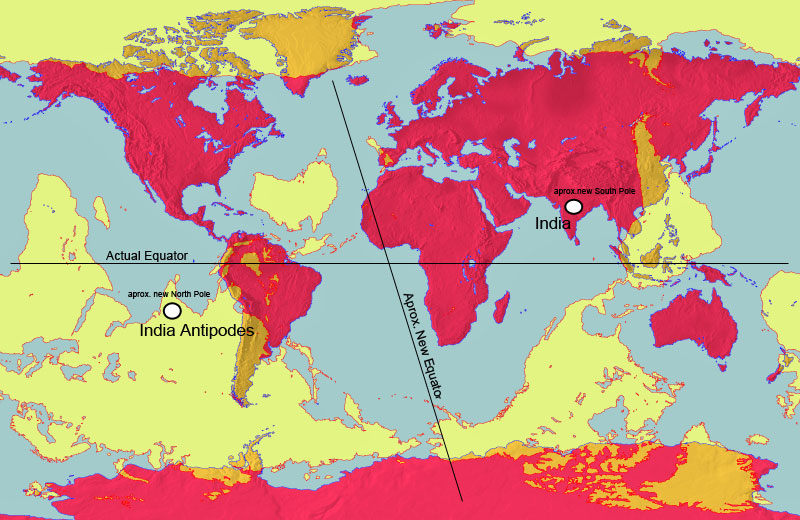
This world map (in red) is overlaid with an antipodal map (in yellow)
showing the antipodes of each point on the Earth's surface.
West Coast
The West Coast of the US in general will suffer an onslaught of changes during the Pole Shift, and those living there need to consider not only each and every onslaught, but the combined effect. First, because the Pacific will shorten and subducting plates will be forced under the coastal plate suddenly and forcefully, heating of the superstrata will occur to an astonishing degree. The rock will actually melt in low lying places.
Thus, valleys over subducting plates are out. Then the tidal waves will assault and where the coastline does not offer an outlet for the water, it will climb up as it has nowhere else to go. Thus, hills and mountain ranges close to the coast are out. Then there are the high winds, or hurricane force, which will occur world wide.
So a safe spot must include being out of the valleys but also out of the wind. Then due to the earthquakes, which will be severe on the significant fault lines that crisscross the West Coast of the US, mountain building will occur which can result in the collapse of caves, even in granite, and renting apart of rock.
Yosemite stands as an example of what can happen. And lastly, forest fires caused by exploding volcanoes, sparks, and lightning storms or perhaps the firestorms that can occur anywhere during the shift, will eliminate the forests as a shelter.
California
California anticipates being inundated, due to the very famous Edgar Cayce predictions along those lines. The state is large, so the many problems befalling it do not necessarily spell disaster for any given family. The major cities along the coast will experience devastation due to earthquakes and be unlivable afterwards. Highly industrialized area will find their surroundings befouled as a result of the quakes.
Reliant on piped water, those in the desert will find themselves without clean water as the ocean inundates inland valleys. The long-term danger in riding out the shift in California, or life afterwards, will be from living near or atop plate boundaries, which will be restless for hundreds of years after the shift.
The volcanoes along these boundaries, even those in Alaska, will waft their volcanic dust along the new prevailing westerlies, which will move them down along the coast, in the direction of the new east. Thus, fishing along the coast will be the best option for survivors, who can return to the coast after the tidal waves have settled.
As California’s geography attests, water has often been trapped in the inland valleys, behind the mountain barriers along the coast, and slowly drained. During the compression of the Pacific, water will wash over these mountains, where ravines or foothills allow the press of water tidal bore, and push up the rivers to flood the inland valleys, which will become an immense flood plain.
After the shift, survivors afloat will paddle about in desperation, as rescue by man will not be forthcoming. The valleys will not drain for some years, by then afloat with the dead bodies of those who were trapped there. Man and beast alike will find themselves squeezed into the mountains to the east, where they will encounter stark desert landscapes poorly suited to supporting hungry survivors.
In the north, California becomes or abuts forestland in foothills or mountains, which offers some safety to those scrambling there from the coast or from farmland valleys that will be inundated. As with all areas, danger from forests set afire from falling firestorms or deluges running waters in force down ravines, exists. Yosemite bears witness to the force of solid rock is subjected to during pole shifts - twisting and pressure upward on one end of a rock strata while pressure downward is applied on the other end - such that solid rock snaps, creating cliffs thou-sands of feet high.
The Sierras show many such scars from the not distant past, as when subduction of plates under California occur, this area is crinkled and compressed. This pole shift will be no different, as the compression of the Pacific will be immense. Thus, such sudden changes in the strata can be expected.
San Diego
A city prized for it’s mild climate and beaches, San Diego will find this proximity to the Pacific its doom. Without mountains as a solid backdrop, waves will wash in and out, over San Diego, as though it were a beach. This will scour the city clean, dragging most of it out to sea and depositing the rest inland as flotsam.
Those seeking San Diego after the shift will be shocked to find it apparently missing. And the remnants will in any case go under water within two years, due to polar melting.
Los Angeles
Los Angeles, the City of Angels, will not fare well during the coming earth changes. Long before the actual shift troubles will beset this city, situated on the Pacific coast and atop many active fault lines. The increasingly severe quakes racking the Earth during this time will escalate to include quakes of a high enough Richter to bring down buildings and bridges in this city dependent upon its freeway system.
Broken gas lines, polluted water lines, and the smog situation made worse by fires in the city will cause a return to riots and police brutality of the past. During the week of rotation stoppage, the crust of the Earth is under severe stress, moaning under this, until the shift causes it to separate from the core and move. During this time, as we have mentioned, the Atlantic is stretched, causing the south-east portion of the US and Caribbean and islands to the west of England to lose some of their elevation, creating flood tide hazard even before the shift itself.
The Pacific likewise has stress, not in a stretch but in a compression. This will cause quakes of a high enough Richter to put Los Angeles into chaos. As the elite in the US are anticipating mobs from LA invading their enclaves higher in the mountains and inland, roads blocked by the military, protecting the elite, can be expected.
Anyone not out of LA by the week of rotation stoppage can anticipate being entombed there, as once the shift starts the flood tide will wash the entire city against the mountain backdrop.
Santa Barbara
The high mountains around Santa Barbara will be safe from the tidal waves during the shift, but after that moment this will be a grim spot. During the week that rotation stops, there will be many who realize that tidal waves can be a factor. Just the legends of the Flood will be enough to start a migration from LA, in all directions.
Even without this, having survived, the mountain tops cannot sustain life and the surrounding land will be under water or salt soggy so that one must migrate inland, and any survivors will not be alone on this trail. Travelers with food stocks will be robbed.
San Francisco
San Francisco is a great tourist attraction, due to the Golden Gate bridge, wine country, China Town, and coastal redwood forests. As with other coastal California cities, it is considered an ideal place to live. This very proximity to the coast is what will doom residents of San Francisco during the earthquakes and Pacific sloshing that will accompany the pole shift.
Situated on the San Andreas and other fault lines, rubble and downed bridges and fires along with a large percentage of the population injured can be expected. So trapped, the residents will find themselves inundated with flood tides so forceful and high that the peninsula itself, all the way to San Jose, will have water flowing over it.
This flood tide will roar through the Golden Gate, clash with the water that has flowed over the peninsula, resulting in roiling water drowning the residents of the many cities around the bay. Survival will be an accident. After the shift, due to the forceful subducting of Pacific plates under West Coast, the bay area will actually be above where it is today, in elevation, even after the melting of the poles.
Water that has flowed inland during the shift will take some time to drain from the inland valleys. However, San Francisco can be anticipated to be a good ocean port for fishing, during the Aftertime, and the oceans will be lush and full of fish.
Arizona
As old rock, not much will happen, even the Grand Canyon remaining unaffected in spite of tempo-rary deluges in the area. During the hour of the shift and hours following, the Colorado River will drain the immense amount of water that will dump on the Rockies, during the clash of water soaked air that will push inland into the Mississippi Valley during sloshing of the Gulf, and similar water soaked air that will push inland into the Sierras during the compression of the Pacific.
Existing drainage routes will serve as the route for this water to rush back to the sea. The Hoover Dam will not survive the Richter 9 quakes, in particular will not survive the heaving and jolting that will go on as the Pacific Plates subducts under the West Coast. Such subduction does not affect only the immediate area, but causes adjustments in neighboring rock strata, sometimes hours afterwards in aftershocks.
We have stated that all river will flood beyond their known flood levels, and that river banks should be avoided, and the Colorado River is no exception. Arizona will be a crowded area going into the shift due to the mystique that many ascribe to this place, particularly Sedona, and thus the poor land and minimal water will be taxed during the Aftertime. Where Arizona rises into the mountains, the highlands offer a better potential for life in the Aftertime.